Lancaster Place
Street in the City of Westminster, LondonLancaster Place is a short section of road in central London, which connects Waterloo Bridge to the major junction with the Aldwych and Strand. It assumed its current name in 1818, shortly after Waterloo Bridge was opened, replacing an earlier road called Wellington Street. Lancaster Place is bisected by the northbound-only Strand Underpass which opened in 1964 and passes below Aldwych, enabling Kingsway-bound traffic to skip the Lancaster Place–Strand–Aldwych junction. Brettenham House and Somerset House front onto the west and east sides of Lancaster Place respectively.
Read article

Top Questions
AI generatedMore questions
Nearby Places

Strand, London
Major thoroughfare in the City of Westminster, London, England

Somerset House
Building on the Strand, London

Courtauld Institute of Art
University in London

Hermitage Rooms
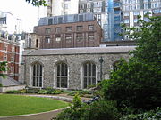
Savoy Chapel
Anglican church in London
Humanitarian Futures Programme

Civil Service Rifles War Memorial
War memorial in Somerset House, London

Walter Besant Memorial
Memorial on the Victoria Embankment, London